From Ocean to Sea through the Pyrenees: The GR10, GR11 and HRP

Crossing the Pyrenees on foot is no mean feat but there are several trails that allow you to do this. Brian Johnson has hiked them all, and here he explains the differences between the three main Pyrenean trekking routes: the GR10, GR11 and the Pyrenean Haute Route (HRP).
What's so special about the Pyrenees?
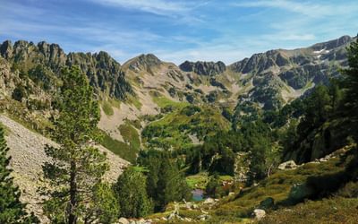
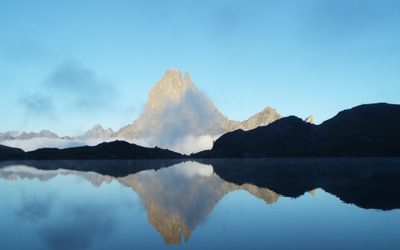
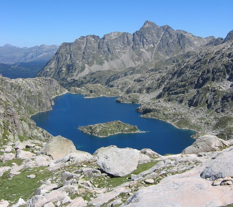
When the British think of European mountains with jagged peaks, impressive snowfields, deep canyons, glacial valleys, alpine meadows and dramatic waterfalls, they usually think of the Alps. However those who have discovered the Pyrenees realise that this mountain chain is every bit as good as the Alps when it comes to scenery, but with fewer people, cars and ski resorts, more unspoilt villages, more charm and a greater feeling of freedom. Perhaps the fact that I’ve now hiked from the Atlantic to the Mediterranean ten times speaks for itself.
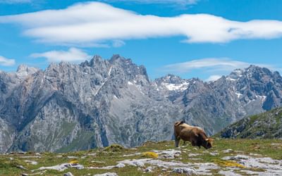
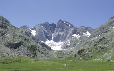
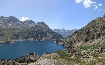
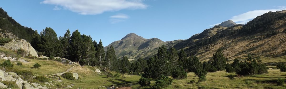
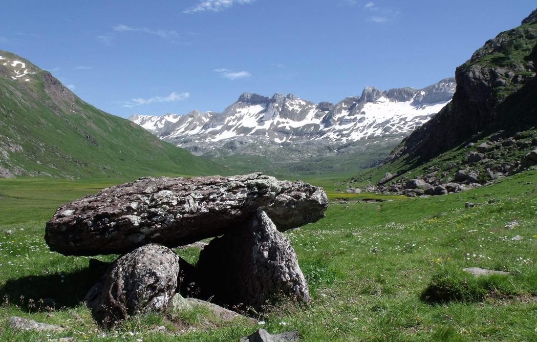
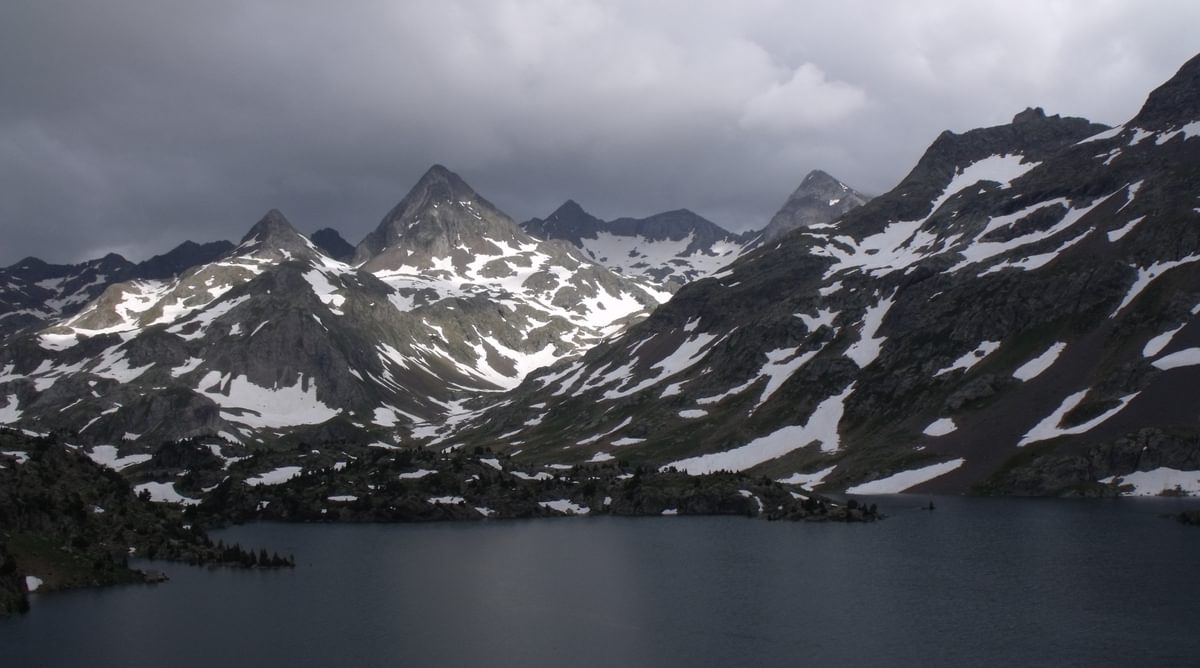
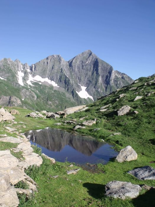
The highest peaks are over 3000m and the predominant rock-types are limestone and granite which provide the most spectacular mountain scenery. The wildflower meadows, along with the butterflies they support, are a delight, and birdwatchers will particularly appreciate the birds of prey, including the massive Griffon vulture which you will see most days. Sights of marmots, chamois and mouflon are also becoming increasingly common.
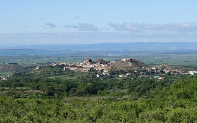
As you pass from the Atlantic Ocean to the Mediterranean Sea you will discover the steep, rolling hills of the Basque Country, rising to 2000m, with easy walking along ridges through pasture, moorland or natural woodland. There is then a rapid transition to the glaciated Alpine mountains of the High Pyrenees. Limestone peaks with soaring cliffs, deep gorges and karst terrain are followed by spectacular granite mountains rising to over 3000m with much bare rock, cascading streams and sparkling tarns. Once east of Andorra the mountains become gentler but peaks still rise to almost 3000m. The final drier mountains as the Mediterranean is approached still rise to over 1000m.
What long-distance paths cross the Pyrenees?
There are two official long distance paths from coast to coast: the GR10 which stays in France and the GR11 which passes through Spain and Andorra. An unofficial third route, the Haute Randonnée Pyrénénne (HRP), isn’t defined, with different authors suggesting different routes, but it stays higher than the GR10 and GR11 and frequently crosses the border between France and Spain. All three routes follow a varied scenic route through magnificent, often remote, mountains. The distance between the Atlantic and Mediterranean is about 400km but the hiking routes will more than double this.
Tell me more about the GR10...
The GR10 – the easiest, oldest and most popular of these routes – remains in France and stays north of the watershed. It's an extremely well waymarked path that follows good mountain paths, with only a few tougher stages with boulderfields to cross and some very easy scrambling. It travels over high passes and although much time is spent climbing up and down steep forested ridges, time is spent above the treeline on every stage. Frequent visits to towns and villages and a network of hostel-style accommodation in gîte d’étape or refuges means accommodation and supplies are rarely a problem. Camping is possible throughout, but is not required.
What about the GR11?
The GR11 is also a well waymarked mountain path which passes through Spain and Andorra. It crosses many high mountain passes where there are boulderfields, scree and some easy scrambling at about the maximum difficulty the inexperienced would want when carrying a heavy rucksack. Frequent visits to towns and villages mean that resupply isn’t much of a problem but accommodation is more limited than on the GR10. Those who prefer not to camp or bivouac will find that a few of the stages are rather long and that some alternative routes will need to be taken.
And the HRP?
The HRP, which passes through France, Spain and Andorra, is not so much a walk as a mountaineering expedition. The route is not waymarked, except where it coincides with other routes, and you must expect to get lost! There is a lot of very rough terrain to cross, including some very steep, possibly dangerous descents. Visits to towns and villages are infrequent so resupply is difficult and you will have to camp much of the time. In my second thru-hike of the HRP I actually went 32 days without passing a food shop! You will cross some difficult passes and spend a lot of time on high mountain ridges with serious risk of thunderstorms. The HRP is particularly demanding in bad weather or in early summer when snow could mean serious winter mountaineering skills are required. Those walkers who are comfortable with backpacking in the rougher British mountains in all conditions should be able to cope. The HRP is a daunting route for the inexperienced but is a magnificent expedition for those who are prepared.
What are the main differences between the trails?
Both the GR10 and Haute Route Pyrenees (HRP) start in France at Hendaye-Plage on the border with Spain and finish in the resort of Banyuls-sur-Mer on the Mediterranean coast while the GR11 starts at Cap de Higuer, just across the border from Hendaye-Plage and finishes at Cap de Creus, a remote peninsular which sticks out into the Mediterranean.
The Pyrenees are steep mountains and there is a lot of steep climbing on all three routes. The GR11 stays higher and is rougher than the GR10, but there is more climb on the GR10 as it drops down into the deep valleys cut by the north-flowing glaciers in the last ice-age. The GR10 is less direct than the other two routes and will take a little longer. Unless you are an experienced mountaineer you should prefer the GR10 or GR11 to the HRP.
The data below gives the approximate distances, climb and hiking time for the three routes. The Cicerone guidebook stages aren’t intended to be a day’s walking but they are convenient stages for those using accommodation and they average out at about 1000m of climb per day which is a good day’s walk for the typical hiker. I've now walked the HRP and the GR11 four times each and generally taken a little under 40 days wild-camping throughout and about 45 days on my two hikes of the GR10.
| Route | Distance | Climb | Stages |
|---|---|---|---|
| GR10 | 955km | 53,000m | 55 |
| GR11 | 820km | 46,000km | 45 |
| HRP | 800km | 44,000m | 45 |
What about accommodation along the routes? Can I camp?
There is some confusion about whether camping is allowed in the mountains. While ‘wild-camping’ is actually illegal in the Pyrenees, you are permitted to ‘bivouac’ with or without a small tent. In practice this means you can camp overnight when you are in the hills, away from habitation, but you cannot leave a camp up through the day. A few areas, particularly national parks and nature reserves have specific regulations on bivouacking, but I had no problems wild-camping throughout my ten coast to coast hikes.
In the High Pyrenees there is a network of manned refuges which provide relatively cheap hostel-style accommodation as well as meals and drinks. In addition, particularly in Andorra and Catalonia, there is a network of unmanned refuges which are similar to the Scottish bothy. The best of these are purpose built and well-maintained, but I would only consider using others in a real emergency. On the GR10 many of the villages, as well as hotels, have ‘gîte d’étape’ which offer cheap hostel-style accommodation and often very good meals. Accommodation is scarcer on the GR11 which may mean those who are not camping will have to use more expensive accommodation. On the HRP there will be times when the only accommodation at the end of a stage is an unmanned refuge.
There are a few tourist ‘honeypots’ in the Pyrenees; the areas around the Pic du Midi d’Ossau, Vignemale, Ordesa Canyon and the Cirque de Gavarnie are particularly popular. The main holiday season is mid-July to late August and you would be advised to book accommodation as far in advance as possible during this period.
What about the weather?
The prevailing wind in the Pyrenees is from the north-west. This means that the Basque country gets more than its fair share of mist and gentle rain which gives the landscape a very green look. It also means that the northern foothills and slopes of the Pyrenees tend to get a lot more cloud and rain than the southern slopes and the Pyrenees become drier as you get further east towards the Mediterranean. The hills to the south of the watershed, especially those to the east, are rather arid. However the hot sunny weather you can expect to the south and east of the watershed can cause terrific thunderstorms. Unlike in most other high mountains, these thunderstorms tend to build up slowly and rather than the afternoon thunderstorm, they often arrive in the evening or even overnight. One surprising thing about the Pyrenees: the weather tends to be better above 2000m than in valleys in France to the north of the watershed. This often produces the magical conditions, especially on the GR10 or in France on the HRP, when you are on mountain ridges in hot sunshine looking down on a sea of cloud with peaks peeping out of the mist.
When is the best time to walk the trails?
The GR10 and GR11 are both designed to be walked when the paths are free of snow and relatively easy walks can turn into serious mountaineering expeditions if you undertake them before the passes are free of snow. This applies to an even greater extent to the HRP which stays higher and crosses more difficult passes. In some years the GR10 and GR11 could be walkable starting from the Atlantic in early June, but recently there have been some high snow years and in 2013 some of the passes were still difficult to cross in early August. In a typical year, unless you are experienced in winter mountaineering and going to carry ice-axe and crampons, it would be unwise to start from the Atlantic before late June. Fresh snow can occur in the High Pyrenees in any month, but summer snowfall should melt quickly and not pose a serious problem to the walker. The Basque Country and Mediterranean mountains can be uncomfortably hot for walking in July and August. Some of the facilities, particularly ski-resorts, are only open in high summer and some of the accommodation will only be open from mid-June to late-September so those requiring accommodation would be advised to complete their hike before the end of September. There is no reason for those who are camping and want the mountains to themselves to finish well into October.
What direction should the trails be walked in?
The Cicerone guides all head west to east for all trails which is the direction I recommend for several reasons:
- The easier walking in the Basque Country enables you to ‘warm up’
- You can become acclimatised to the heat before reaching the Mediterranean
- The most difficult descents on both the GR10 and GR11 are encountered when walking from east to west
- The bigger gaps in resupply and accommodation are in the east and as you get fitter it will be easier to cope with the long days this involves
- Any rain is likely to be on your back rather than in your face. Assuming you make early starts you can often do the morning climb in the shade before the sun rises above the ridges

Trekking the GR10
Through the French Pyrenees: Le Sentier des Pyrenees
£18.95
Guidebook to walking the GR10, the Sentier des Pyrenees, a 955km trek across the French Pyrenees from Hendaye on the Atlantic coast to the Mediterranean coast at Banyuls-sur-Mer. The book describes 55 stages, with information on planning, transport, accommodation and facilities. Walk the entire GR10 in around 45 days or in shorter trips.
More information
Trekking the GR11 Trail
The Traverse of the Spanish Pyrenees - La Senda Pirenaica
£18.95
The GR11 trail traverses the Spanish Pyrenees from Irun on the Atlantic coast to Cap de Creus on the Mediterranean. Leading over high passes and through sweeping valleys, the 850km route is presented in 47 stages. Trekkers require experience of high mountains.
More information
The Pyrenean Haute Route
The HRP high-level trail
£18.95
Guidebook to trekking the Pyrenean Haute Route, which zigzags across the Franco-Spanish border, staying close to the main ridge in the highest and most spectacular Central Pyrenees. It covers 750km with over 40km of ascent, so is suitable for experienced mountain walkers only. The largely unwaymarked route is presented in 44 stages.
More informationSadly, Brian passed away in 2021. One of Cicerone's great authors, he is hugely missed by all who knew him and the many more he inspired through his adventures. For a full obituary, please see Brian Johnson.
He wrote a number of guidebooks, including Shorter Treks in the Pyrenees. For a full listing of Brian's books, see Brian Johnson | Cicerone Press.
To read more articles like this get our newsletter
Sign up for 20% off your next purchase and to be the first to hear about exclusive competitions, special offers, and news from Cicerone.