Top 10 Hillwalks in Shropshire

Guidebook author John Gillham shares his ten favourite hillwalking spots in Shropshire. Shropshire’s not a place associated with charts or hill lists but these hills deserve to be celebrated.
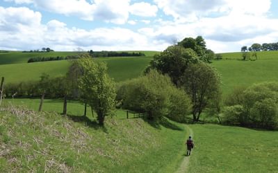
Shropshire bridges the gap between the mountains of mid Wales and the industrial flatlands of the Black Country. It’s an extremely rural county with only two sizeable towns, Shrewsbury and Telford. From any of its hillsides you’ll be able to look down on a patchwork of greenery, undulating pastures and arable farmland, divided by hedges, rivers and woodland copses. It’s never truly mountainous, but has enough distinctive peaks and rocks to keep the walker happy for decades.

Hillwalking in Shropshire
32 hill and country walks
£12.95
Guidebook to 32 walking routes in Shropshire in the West Midlands. The routes range from 3 miles (5km) to 12 miles (19km), taking in highlights such as The Wrekin, Wenlock Edge, Long Mynd and Stiperstones, Castle Ring and Bury Ditches. Many routes start near delightful towns and villages including Church Stretton, Ludlow and Bishops Castle.
More informationYou can get 20% off our Hillwalking in Shropshire guidebook. Just use code SHROPSHIRE at checkout.
10. Brown Clee Hill
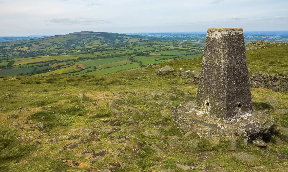
Brown Clee is the highest hill in Shropshire, so it has to be included. It rises to 540m at Abdon Burf and is capped with dolerite – known locally as Dhustone – laid down on beds of sandstone, coal and limestone. This geological structure has led to exploitation on an industrial scale, and an exploration of the hill will reveal bell (coal) pits, quarries, small reservoirs and, on the summit, a scattering of communications masts.
If all this sounds depressing, there are many redeeming features to make a visit to Brown Clee Hill worthwhile. Its height and relative isolation means that it offers uninterrupted views of Shropshire and its hills, including Wenlock Edge, the Stretton Hills, the Long Mynd and the wrinkled crest of Stiperstones, with Snowdonia and the Brecon Beacons appearing on the horizon if conditions are clear enough. Away from the masts there are unspoiled places and in August the mottle of heather and bilberry gives the ridge a really colourful cloak. The Iron Age fort at Nordy Bank, on Clee Liberty, is impressive, especially seen from above, when the earthwork rings are highlighted by the sun’s rays.
The best approaches to Brown Clee Hill are from Cockshutford via Nordy Bank and Clee Burf, and from the Stanbroughs Wood picnic site near Cleobury North.
9. Stapeley Hill
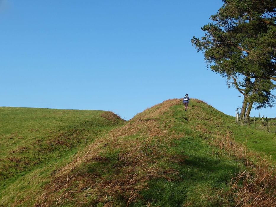
Stapeley Hill is a squat, unassuming ridge running parallel to Stiperstones. It is totally dominated by its next door neighbour Corndon Hill, which lies just over the Welsh border, and yet the area is so suffused in ancient history that this doesn’t matter a jot. This glorious ridge of grass and rock is scattered with ancient cairns, some dating back to the Bronze Age. There’s a Bronze Age stone circle at Mitchell’s Fold dating back to between 2000–1200bc, consisting of 30 stones, of which only 15 are still visible, forming a circle of over 24m (80ft) in diameter.
The best walk to Stapeley begins at the Abel’s Harp Inn at Bromlow and includes a visit to Bromlow Callow, a grassy knoll topped by a copse of conifers. It is assumed that Bromlow Callow was a sheltered meeting place for drovers on their way to or from the cattle markets of the West Midlands or Mid Wales, but nobody knows for sure. Next comes a stroll across the Stapeley Ridge, visiting the stone circle and the secret hollow of Valley Knoll. A shorter circular walk beginning at the Mitchell’s Fold car park could take in Stapeley Hill but omit Bromlow Callow.
8. Titterstone Clee Hill
The third highest hill in Shropshire shares much of its geology with neighbouring Brown Clee Hill, and has also been exploited for its minerals. The summit is littered with relics of quarrying and is topped by two gleaming white radomes, one for controlling air traffic and the other for checking weather. It’s easy to imagine bygone times, when the area echoed to the sounds of industry, including gunpowder explosions and the clank, clank of the railway carrying stone down to the valley below.
Flint tools of Mesolithic hunters found on the slopes of Titterstone show that the area was populated in earlier times, after the last Ice Age retreated. The Iron Age settlement on the summit was the largest of its kind in Shropshire but has been damaged and obscured by quarrying. Part of the ancient wall, now a low line of rocks, can be seen on the slope below the cairn. The most notable feature of the hill is Giant’s Chair, a grouping of summit rocks formed in the last Ice Age. There’s a car park just below the summit, but a more satisfying walk can be undertaken from the village of Cleeton St Mary to the east.
7. Llanfair Hill and Offa’s Dyke
Initially, the borders between Wales and England were the mountains themselves, but continuous skirmishes between warlords made it necessary to define them more clearly. So in the 8th century King Offa of Mercia did just that, building a walled dyke from the English Channel to the Irish Sea. Offa’s Dyke is never more impressive than on Llanfair Hill, near the Welsh border town of Knighton. Here the earthworks are well-preserved, and rise to 430m (1410ft) above sea level.
There’s a good walk starting near Llanfair Waterdine, once home to mountaineer John Hunt (Baron Hunt), leader of the first successful Everest expedition of 1953. When you reach the Dyke you have a splendid, easy striding ridge with that ‘on top of the world’ feeling. It may well make you want to try the whole Offa’s Dyke long distance path.
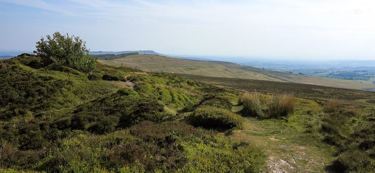
6. The Lawley
The Lawley is not big – it rises to a mere 377m (1236ft) above sea level and the ridge is just 3km (2 miles) in length – but this hill offers its visitors the best pure ridge walk in the county. While it’s no Crib Goch the ridge is narrow, with beautiful short-cropped grass. Being the most northern outlier of the Church Stretton hills the summit has far-reaching views across the Shropshire plains.
Writers often talk about free-striding ridges: none are more free-striding than the Lawley. Try it for a short evening walk to catch the setting sun. There’s a car park at the north end of the ridge, east of Leebotwood. Or, if you have a full day to spare, combine it with Caer Caradoc and Hope Bowdler Hill.
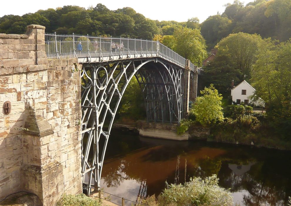
5. Ironbridge Gorge
Despite its not being a hill, no Shropshire trip would be complete without a visit to the Ironbridge Gorge, where the mighty River Severn forges its way through low wooded hills surrounding Ironbridge, Coalport and Jackfield. The Industrial Revolution began here, a fact recognized by UNESCO when they declared it a World Heritage Site in 1986. In 1708 Abraham Darby leased the Coalbrookdale furnace and became the world’s first mass producer of cast iron. As a result Thomas Telford designed the first cast iron bridge nearby in 1779, to link the important industrial towns of Broseley and Madeley.
Today the valley’s industries have ceased, the railway has become a bridleway and the factories are museums, but together they offer a fascinating insight into those 18th- and 19th-century worlds. A walk on the hillsides and in the valley passes Blists Hill, a re-creation of an industrial Victorian town, the Coalport China Museum, the Jackfield Tile Museum and of course the Iron Bridge. Ironbridge has become a tourist village with fascinating shops, riverside cafés and pubs and plentiful accommodation.
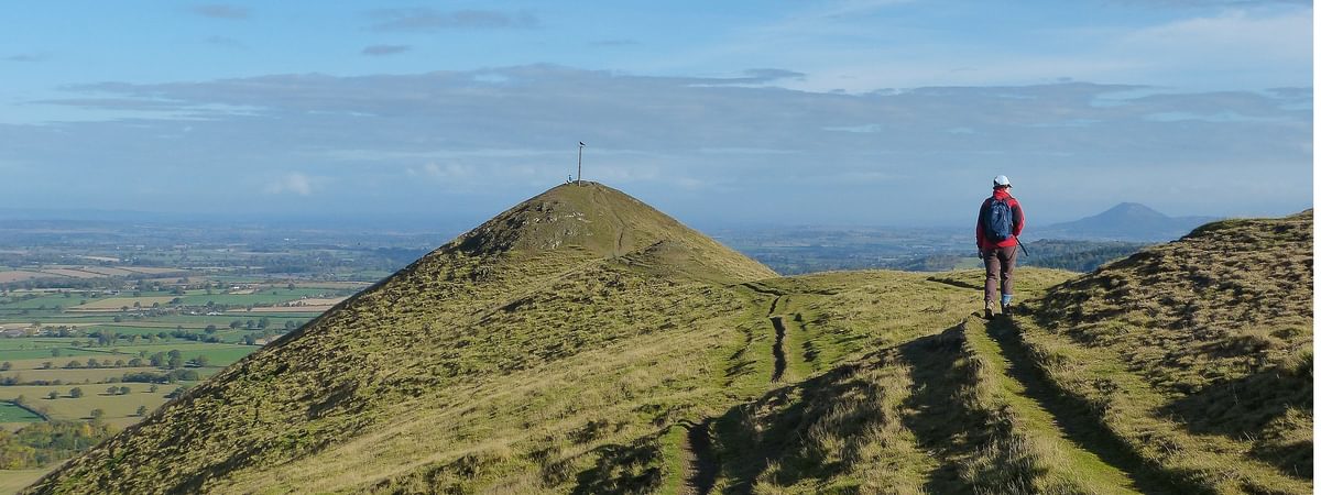
4. The Wrekin
This hog’s-back hill overlooking Telford can be seen from most of Shropshire, as it’s surrounded by flat land on all sides. Formed by volcanic eruptions triggered by the nearby Church Stretton fault, the Wrekin consists of various igneous rocks including rhyolite and tuffs. While the sides are heavily wooded the summit is largely open, and is capped not only by those rocks but by a 20 hectare Iron Age fort, once home to the Celtic Cornovii tribe ruled by the great warrior Virico. The Romans built their city, Wroxeter, just four miles away, and battles ensued. The Romans were victorious but Virico must have put up a good fight: the Romans named their city Viroconium. In 1990 there was a small earthquake due to a slight shifting of the Church Stretton fault. Only minimal damage was caused, but a stone was displaced and lodged in the cleft of the Needles Eye rocks.
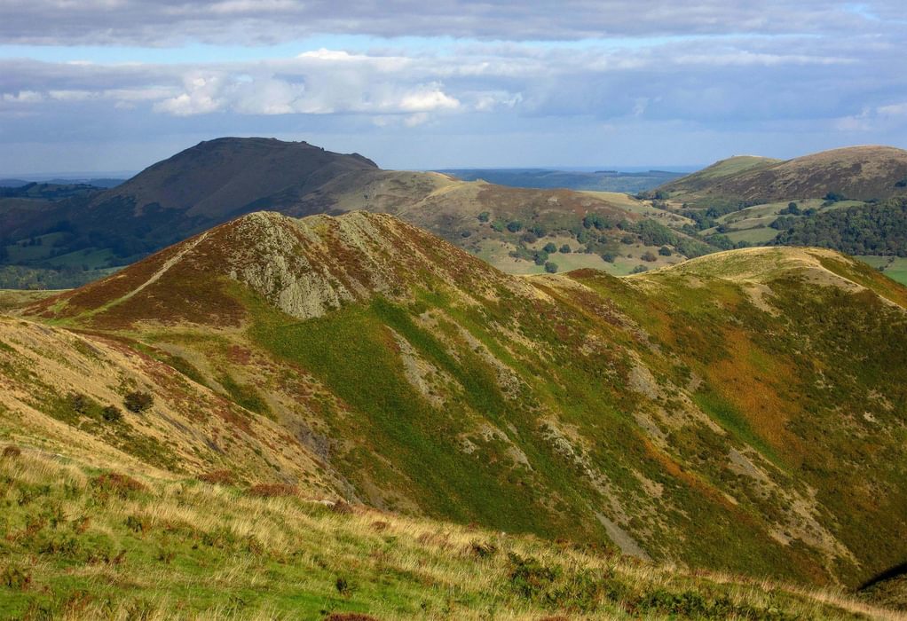
3. Long Mynd
This broad, 11km (7 mile) heather ridge lies to the west of the Church Stretton Fault and to the east of the East Onny Valley. It’s the most popular of all the Shropshire Hills, due to the conveniently sited base of Church Stretton. Several crag-fringed, steep sided batches (small valleys) cut into the ridge on this side and provide superb walks to the tops. The most popular of these, the Carding Mill Valley, is managed by the National Trust, who have built a café and visitor centre. This, however, is outshone by Ashes Hollow, a long twisting batch above Little Stretton. The ancient road known as the Portway is now a wide stony track and runs along the ridge’s crest, just by-passing the highest summit, Pole Bank, which has a view indicator. The rockiest top, known as Devil’s Mouth, is above the Townbrook Valley: the best waterfall is known as Lightspout, which is easily accessed from Carding Mill; and the best downhill biking track is in Minton Batch (to be avoided by unsuspecting walkers).
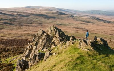
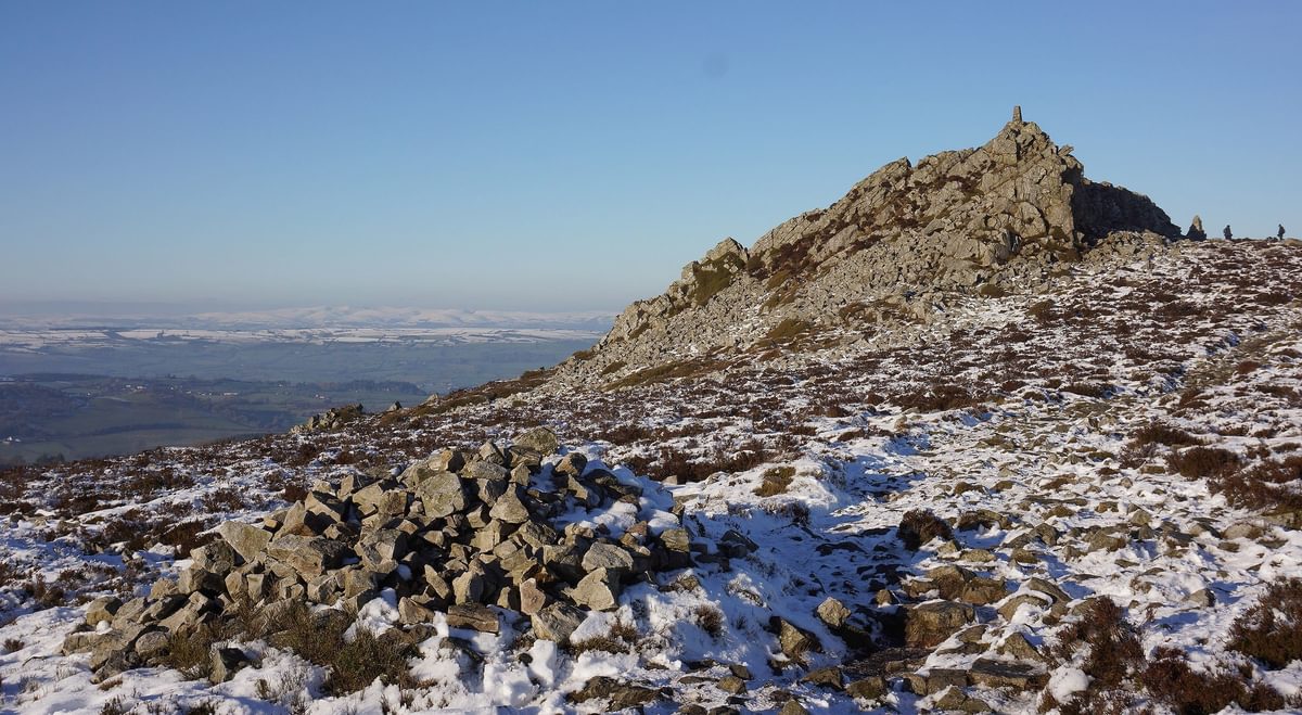
2. Stiperstones
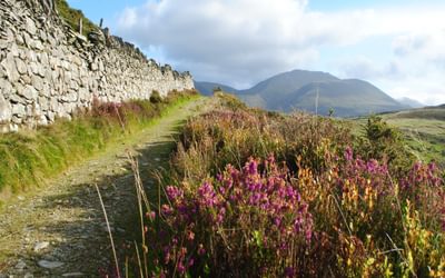
The Stiperstones ridge, to the north east of the Long Mynd, is easily recognised thanks to the jagged quartzite summit tors at the southern end of the ridge. Nearly 500 million years ago the mountain’s summit ridge would have risen out above glaciers. The ground was subjected to constant freezing and thawing, which shattered those rocky tors and formed screes. The most prominent of the crags are the Devil’s Chair, Shepherd’s Rock and Manstone Rock, which is the highest point.
In the north Stiperstones becomes more complex, with other ridges branching off to the west, divided by several steep-sided coombes known as dingles. At the bottom of Mytton Dingle is Stiperstones village, where the Stiperstones Inn – the ideal base for exploring these parts – offers refreshment. Most routes begin from the car parks at Snailbeach in the north and the Bog and the Knolls in the south. In the south the paths are roughly surfaced with irregular quartzite boulders, while in the north they’re easier to negotiate.
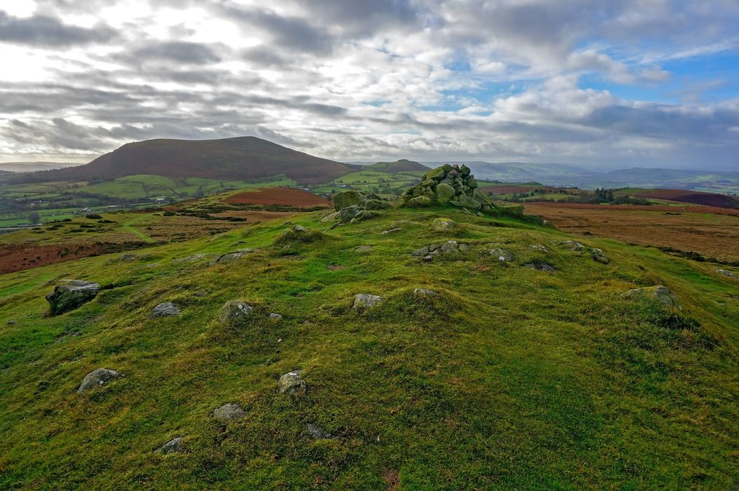
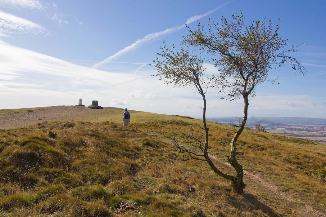
1. Caer Caradoc
Caer Caradoc is part of a range known as the Stretton Hills and, although not the tallest of Shropshire’s hills, it is the most iconic, with a distinctive shape and precipitous sides studded with dark volcanic rocks. The hill sits alongside the Church Stretton Fault, part of a great rift – the dividing line between two tectonic plates – that stretches from Cheshire to South West Wales. The plate in the west sank beneath the one in the east, forcing it upwards. The heat that ensued brought about the volcanic action that formed the crags of Caer Caradoc and surrounding hills east of the fault.
Caer Caradoc’s summit is topped by a large Iron Age fort. Caradoc, or Caractacus, as he is sometimes known, was a British chieftain who, along with his armies of Ordovician and Silurian soldiers, resisted the Romans under the rule of Claudius for over a decade. Legend has it that Caradoc fought his final battle on this mountain, one in which he was defeated by the Roman general Ostorius Scapula.
Caer Caradoc is best scaled in combination with the Lawley, the Hope Bowdler Hills to the east, or both. The best starting points for exploration are Church Stretton or the roadside layby by Gaerstones Farm on the Much Wenlock road out of Church Stretton.

… and it doesn’t end there
Shropshire has so much more to offer the walker. I haven’t mentioned Wenlock Edge, a limestone escarpment stretching 19 miles (31km) from Much Wenlock to Craven Arms. It’s a Site of Special Scientific Interest due to the abundance of fossils embedded in the limestone, and has many superb woodland bridleways and paths. Walks through the county will take you to castles and forts including the magnificent riverside fortress at Ludlow; the one at Clun, which was sacked by Welsh leader Owain Glyndwr; and the quirky Stokesay castle. The Iron Age fort at Bury Ditches to the north of the Clun Valley is regarded to be one of the finest examples of its type in England. Isn’t it time for a visit?

Walking the Shropshire Way
A two-week circular trail including the Wrekin, Stiperstones and Wenlock Edge
£14.95
Guidebook describing a 2 week trail around Shropshire. The 182 mile (290km) route is made up of two loops centred on Shrewsbury and visits Stiperstones, Wenlock Edge, Ironbridge and the Wrekin. Also describes the challenging 20 mile (32km) Stretton Skyline Walk.
More informationTo read more articles like this get our newsletter
Sign up for 20% off your next purchase and to be the first to hear about exclusive competitions, special offers, and news from Cicerone.