The Yellow Line - Cycling the Tour de Peak District

There’s a yellow line on the OS maps which marks the boundary of the Peak District National Park. Having cycled many of the delightful quiet and scenic roads along that line on the eastern side of the Peak, Chiz Dakin began to wonder about the western and northern sides. Did that yellow line continue to form the basis of a pleasant cycle route all around the National Park?
And so, well before the Tour de France entered Yorkshire and the Northern Peak, the idea of turning the Peak District boundary into a circular cycling route was born.
Enter a 250km (155 mile) multi-day challenge that takes ‘the nearest nice line to the Peak District National Park boundary’. And which forms the finale to my Cycling in the Peak District guidebook.
Since then, canal towpaths have become legal to ride on and a few other route options have become viable too. As the original route took a decidedly off-road line in the west, I was keen to find a complementary road version – although, as with previous efforts to find a gentle-enough off-road version, this proved harder than I’d hoped. I pored over maps, and rode a few alternatives to get the beginnings of the road route. It would be quite urban in places, but that’s simply the nature of the terrain on the ground. It would show a different side to the Peak District boundary; the exercise spawned some good ideas for alterations to the main route, too.
All too soon I’m winding my way up the relentless hill onto Beeley Moor. My legs slowly grind round on the pedals, being determined I will make it to that tree 20m away; no, the next one; that pebble on the road; that stone in the wall… It’s the first real test of the trip and I’m thankful I stopped at a café near the start of the route – my legs clamour that the protein and caffeine was much needed and can they have some more, please?
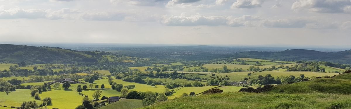
But now I’m up on the plateau – and the weather is clearing. A tail wind sweeps me along the moortop, and the miles fly by. East Moor, Leash Fen; soon I’m whizzing down the hill to Cordwell. Eek – horse ahead! Slow down and pass gently by.
I make fast progress along the main roads between Owler Bar and Houndkirk Road near Fox House. There’s not much alternative to these roads, but it being midweek and out of school holidays means they’re quiet. With good visibility ahead, both roads are far less scary than might be expected. Then it’s all change to pace and terrain on the Houndkirk Road track, with its rough loose surface making a fun mental challenge: finding the easy line between underlying rock and overlying loose stones.
Now I’m flying along the tarmac again from Ringinglow, and suddenly the deep Rivelin valley comes into view. It’s always very impressive, yet somehow a photo never quite captures the impact of apparent depth – as well as the threat of steep sided torture on the far side! But it’s never as bad as it looks from that first glimpse.
The hills come steep and often beyond Rivelin. I determinedly push on beyond Dungworth, and it’s getting late as I hit the Transpennine Trail (TPT). Fortunately, the going is easy: then I realise that tonight’s accommodation is a mile outside Penistone, and up a hill.
It’s a good thing the next day eases in gently, with a flat 10km on the TPT. But, after a stop to admire the views over Dunford Bridge, the hills soon begin again. They seem easier going today, however; I’m more relaxed, and my legs have settled down to enjoying it. And the sun is out from the start, which always helps.
A fast descent into Meltham at traffic speed is thoroughly enjoyable, although the hilliness within this linear town less so. The day is warming up significantly now: fresh fruit and a cold drink prove a greater temptation than a café. Rehydrated again, there’s a steep hill to get over before Linthwaite: the descent down Hoyle Ing is very steep and not the place to discover you have any braking issues.
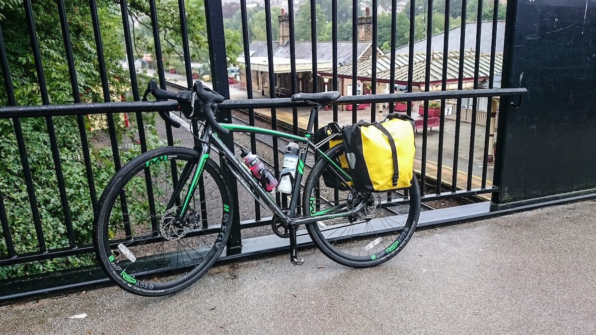
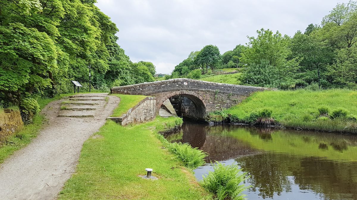
There’s a series of short but fun challenges at each lock along the Huddersfield Narrow Canal to Marsden. Can I make it up each rise without dismounting for a few metres – or not? The ones where it rises underneath a road-bridge are particularly challenging. I make it up all but a couple before the towpath ends at Marsden. From here the canal vanishes into the 5km Standedge tunnel, where bargemen used to have to ‘leg’ their way through with their feet on the tunnel roof.
The long, relentless climb out of Marsden onto the moorland above passes without incident, but the Standedge cutting ahead is worrying me. There’s no on-road alternative to the A62 over this, but as it happens this major road turns out to be surprisingly quiet. It’s probably still best to avoid at rush hour, but the dual uphill lane works well in this direction – the traffic is light enough that cars simply use it to overtake you with plenty of room. And the descent on the far side into Diggle is fantastic!
As I bounce down the start of the Tame Valley Way I decide it’s too rough for a road route, but the rough surface soon eases. The trail now continues smoothly to Mossley, where a decidedly urban section to Charlesworth begins.
At first, this is a bit disappointing – it’s very urban, and the hill out of Stalybridge is a killer which gets steeper as you turn the corner. And I can’t find any cafes on the route, either (I should have detoured earlier onto Uppermill’s main street or into Stalybridge station for a café/pub – dehydration is contributing a lot to my unhappiness).
A couple of stiff climbs up to the ridge above Rowarth and the pleasant Sett Valley Way are now all that remains before tonight’s bed in Hayfield. I’ve successfully compressed the first three days of the route into two, but I realise again that it’s not the distance that makes this route a challenge, it’s the cumulative ascent (4000m ascent so far, of a total 6000m on the route).
As I reach Disley the next morning my plans are thwarted: reservoir works have shut the road again (this is no longer an issue). I could catch the train from Disley station to avoid the A6, or backtrack to Whaley Bridge and take the Peak Forest canal. In the end, I gather up my mental courage and take to the A6: it’s not far to the Macclesfield Canal and then the Middlewood Way.

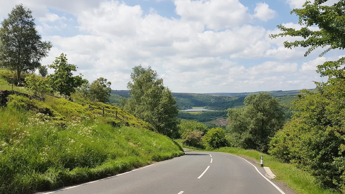
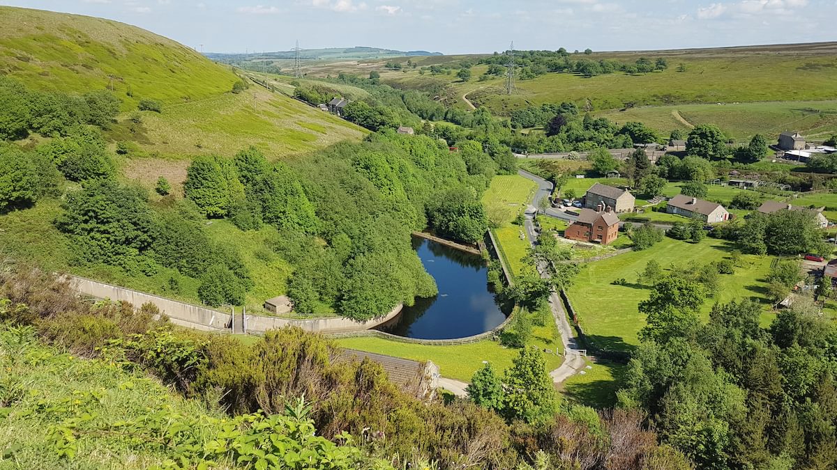
This ends at the impressive Bollington Viaduct, from which it’s a stiff climb out of town and up the side of Kerridge. The rest of the day passes in a series of sweeping rises and descents, the best being the long, flowing descent past Wincle into Danebridge, then a further rise over Gun Moor before the descent to Tittesworth Reservoir – where the views in the late afternoon light, out towards the Roaches, are fabulous.
The final morning dawns wet and miserable. I delay my start for an hour, drinking coffee in the hope the rain will go. It lessens from a torrent to drizzle, then abruptly begins to clear. The rise onto Morridge is no less a slog, but the views make up for it, likewise the descent into Waterhouses.
The Tissington Trail makes easy work of the ascent out of Ashbourne although I wuss out of the ford this time – mid-summer heat is better for that! And then it’s a relatively short climb back over Matlock Moor to the start.
Inevitably, the route changed a bit with further recces after this ride, but it still holds true to its intentions of the ‘nearest nicest route around the Peak District National Park boundary’.
To read more articles like this get our newsletter
Sign up for 20% off your next purchase and to be the first to hear about exclusive competitions, special offers, and news from Cicerone.